AAU Herbarium Database |
| New Search Modify Search |
| Collector | Balslev, H. |
| Number | 8349 |
| Collected with | D. Pedersen, M.V. Sørensen, A.K. Brunbjerg & C. Grández |
| Country | Peru |
| Subpart | Madre de Dios |
| County | |
| Locality | Tambopata province. 16 km NE of Puerto Maldonado, 0.5 km NE of Estacion Cientifica Ita. North bank of Río Madre de Dios. Primary forest on floodplain |
| Coordinates | 12° 32' 3.84'' S 69° 2' 50.1'' W |
| Minimum elevation (m) | 182 |
| Maximum elevation (m) | 182 |
| Start date | 2011/03/20 |
| End date | 2011/03/20 |
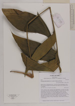
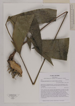
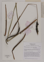
| Family | Arecaceae |
| Identification | Geonoma macrostachys var. acaulis (Mart.)A.J.Hend. |
| Determined by | Henrik Balslev |
| Identification qualifier | |
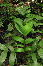
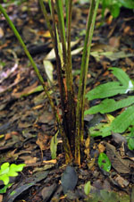
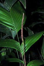
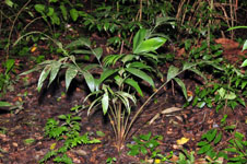
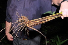
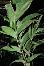
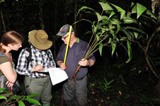
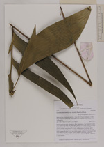
| Field notes | Solitary understory palm. Acaulecent. Stem subterranean, 3 cm thick. Few visible roots. Leaves 9 per stem; leaf sheath open; petiole 70 cm long; rachis 36 cm long; lamina pinnate, 56 cm long, 36 cm wide, flat, glabrous; pinnae 3 per side, insertion regular; basal pinnae 27 cm long, middle pinnae 30 cm long, apical pinnae 33 cm long. Inflorescence interfoliar; prophyll 10 cm long, 0.8 cm wide, papery; peduncular bract 22 cm long, brown, papery; peduncle 75 cm long, 0.5 cm wide; spike 16 cm long, 0.8 wide. Flowers sunken. Local name: Palmitche; informant: Javier Reategui. Silica gel sample taken. Transect: HB 406, subunit no. 1, inside transect |
| |
| Display all 211 georeferenced records of Geonoma Geonoma macrostachys var. acaulis |
| New Search Modify Search |