AAU Herbarium Database |
| New Search Modify Search |
| Collector | Balslev, H. |
| Number | 8344 |
| Collected with | Dennis Pedersen & Roberto Carrillo |
| Country | Ecuador |
| Subpart | Santo Domingo |
| County | |
| Locality | 15 km E of Sto. Domingo. Tinalandia Lodge. Forest fragment on steep premontane hills. Primary forest. |
| Coordinates | 0° 18' 29'' S 79° 2' 58'' W |
| Minimum elevation (m) | 828 |
| Maximum elevation (m) | 828 |
| Start date | 2011/01/06 |
| End date | 2011/01/06 |
| Family | Arecaceae |
| Identification | Geonoma cuneata var. procumbens (H.Wendl. ex Spruce)Skov |
| Determined by | Balslev H. |
| Identification qualifier | |
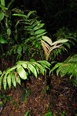
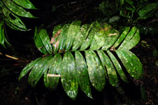
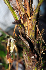
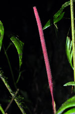
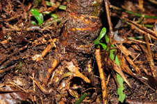
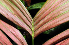
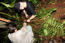
| Field notes | Solitary understory palm. Stem 0.2 m long, 4 cm in diameter, brown, smooth; internodes 1 cm long; base of stem with few visible roots. Leaves 8; sheath 18 cm long, open; petiole 25 cm long, section round; rachis 45 cm long; lamina pinnate, 45 cm long, 30 cm wide, flat; pinnae 12 per side, regularly inserted; basal pinna 15 cm long, middle pinna 20 cm long, apical pinna 13 cm long. Inflorescence interfoliar; prophyll 17 cm long, 1.5 cm wide, papery; peduncular bract 40 cm long, brown, papery; peduncle 42 cm long, 0,5 cm wide; spike 18 cm long. Flowers sunken. DNA sample taken. Transect RC21, subunit no. 099, in transect |
| |
 Other records of Geonoma cuneata var. procumbens Other records of Geonoma cuneata var. procumbensThe map displays only records from the Aarhus Herbarium Database. The records may not represent the full distribution of Geonoma cuneata var. procumbens |
| New Search Modify Search |