AAU Herbarium Database |
| New Search Modify Search |
| Collector | Balslev, H. |
| Number | 8324 |
| Collected with | Alexander Parada & Yanina Inturias |
| Country | Bolivia |
| Subpart | La Paz |
| County | |
| Locality | Franz Tamayo province. 187 km N of La Paz, 19 km ESE of Apolo, 4 km SE of Pucasuchu. Montane rainforest |
| Coordinates | 14° 49' 21.4'' S 68° 16' 12.3'' W |
| Minimum elevation (m) | 1563 |
| Maximum elevation (m) | 1563 |
| Start date | 2010/08/20 |
| End date | 0/00/00 |
| Family | Arecaceae |
| Identification | Prestoea acuminata (Willd.)H.E.Moore |
| Determined by | Balslev H. |
| Identification qualifier | |
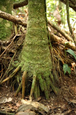
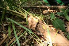
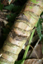
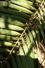
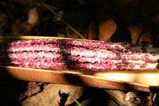
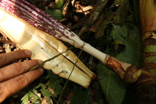
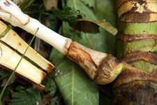
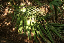
| Field notes | Solitary midstory palm. Stem 6 m long, 7 cm thick, smooth; internodes 9 cm long; base of stem with few visible roots. Leaf sheath 60 cm long, closed; petiole 27 cm long, section margined; rachis 213 cm long; lamina pinnate, 230 cm long, 95 cm wide, glabrous; pinnae 45 per side, regularly inserted; basal pinna 47 cm long, middle pinna 58 cm long, apical pinna 18 cm long. Inflorescence infrafoliar; prophyll 18 cm long, 4 cm wide, woody; peduncular bract 60 cm long, brown, woody; peduncle 10 cm long, 2 cm wide; rachis 47 cm long, 1 cm wide; rachillae 75, 7-35 cm long. Flowers sessile, dark purple. Transect HB160, subunit no. 068, inside transect; UTM: 19L-578538-8361167 |
| |
 Other records of Prestoea acuminata Other records of Prestoea acuminataThe map displays only records from the Aarhus Herbarium Database. The records may not represent the full distribution of Prestoea acuminata |
| New Search Modify Search |