AAU Herbarium Database |
| New Search Modify Search |
| Collector | Balslev, H. |
| Number | 8316 |
| Collected with | Alexander Parada & Yanina Inturias |
| Country | Bolivia |
| Subpart | La Paz |
| County | |
| Locality | Franz Tamayo province. 161 km N of La Paz, 38 km SSE of Apolo, 4.5 km SSW of Munaypata. Montane rainforest on relatively flat terrain |
| Coordinates | 15° 3' 33.9'' S 68° 19' 30.7'' W |
| Minimum elevation (m) | 1214 |
| Maximum elevation (m) | 1214 |
| Start date | 2010/08/17 |
| End date | 0/00/00 |
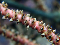
| Family | Arecaceae |
| Identification | Geonoma interrupta var. euspatha (Burret)A.J.Hend. |
| Determined by | Balslev H. |
| Identification qualifier | |
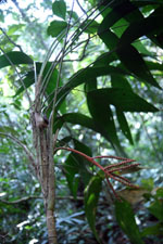
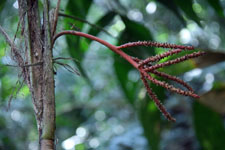
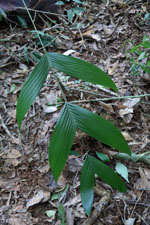
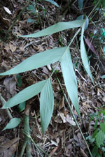
| Field notes | Solitary understory palm. Stem 1.8 m long, 2 cm thick, smooth; internodes 1-2.5 cm long, yellow. Leaves 13; leaf sheath 20 cm long, open; petiole 50 cm long, section margined; rachis 47 cm long; lamina pinnate, 66 cm long, 50 cm wide, glabrous; pinnae 2-3 per side; basal pinna 38 cm long, middle pinna 30 cm long, apical pinna 40 cm long. Inflorescence interfoliar; peduncle 18 cm long, 0.5 cm wide; rachis 8 cm long, 0.4 cm wide; rachillae 7, 6.5-12 cm long. Flowers cream. Transect HB157, subunit no. 042, inside transect; UTM: 19L-572529-8334991 |
| |
 Other records of Geonoma interrupta var. euspatha Other records of Geonoma interrupta var. euspathaThe map displays only records from the Aarhus Herbarium Database. The records may not represent the full distribution of Geonoma interrupta var. euspatha |
| New Search Modify Search |