AAU Herbarium Database |
| New Search Modify Search |
| Collector | Balslev, H. |
| Number | 8311 |
| Collected with | Alexander Parada & Yanina Inturias |
| Country | Bolivia |
| Subpart | La Paz |
| County | |
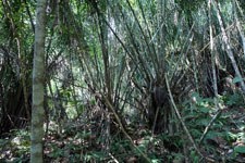
| Locality | Franz Tamayo province. 164 km N of La Paz, 37 km SSE of Apolo, 2 km SSE of Munaypata. Montane rainforest on steep slopes |
| Coordinates | 15° 2' 13.4'' S 68° 18' 14.9'' W |
| Minimum elevation (m) | 1045 |
| Maximum elevation (m) | 1045 |
| Start date | 2010/08/16 |
| End date | 0/00/00 |
| Family | Arecaceae |
| Identification | Attalea phalerata Mart. |
| Determined by | Balslev H. |
| Identification qualifier | |
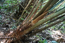
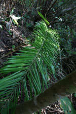
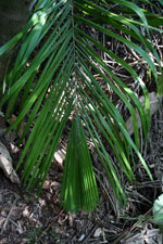
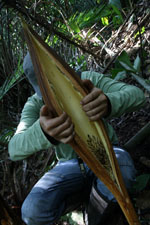
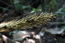
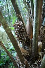
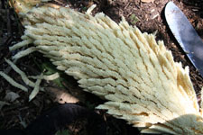
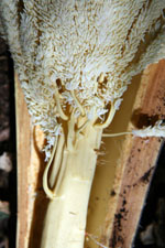
| Field notes | Solitary midstory palm. Leaves 8; leaf sheath 80 cm long, open; petiole 2.3 m long, section margined; rachis 5 m long; lamina pinnate, 5.25 m long, 1.6 m wide, glabrous; pinnae 171 per side, inserted in groups of 3; basal pinna 60 cm long, middle pinna 80 cm long, apical pinna 25 cm long. Inflorescence interfoliar; prophyll 18 cm long, 7 cm wide, woody; peduncular bract 1 m long, brown, woody; peduncle 60 cm long, 2 cm wide; rachis 30 cm long. Flowers cream. Transect HB156, subunit no. 086, inside transect; UTM: 19L-574800-8337459 |
| |
 Other records of Attalea phalerata Other records of Attalea phalerataThe map displays only records from the Aarhus Herbarium Database. The records may not represent the full distribution of Attalea phalerata |
| New Search Modify Search |