AAU Herbarium Database |
| New Search Modify Search |
| Collector | Balslev, H. |
| Number | 8261 |
| Collected with | Alexander Parada & Yanina Inturias |
| Country | Bolivia |
| Subpart | Cochabamba |
| County | |
| Locality | Carrasco Province. 154 Km ENE of Cochabamba, 11.5 km SE of the village of Ivirganzama, along the Cochabamba - Sta. Cruz highway. Valle del Sacta, km 7 on road to Siglo XX. Lowland tropical rain forest |
| Coordinates | 17° 2' 9'' S 64° 44' 39.3'' W |
| Minimum elevation (m) | 233 |
| Maximum elevation (m) | 233 |
| Start date | 2010/08/02 |
| End date | 0/00/00 |
| Family | Arecaceae |
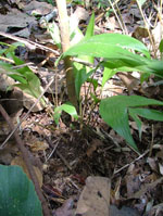
| Identification | Geonoma brevispatha Barb-Rodr. |
| Determined by | Balslev H. |
| Identification qualifier | |
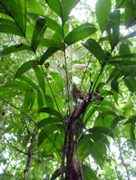
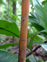
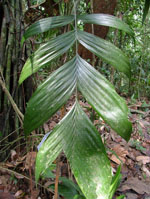
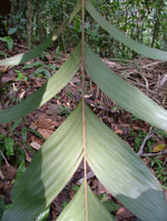
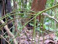
| Field notes | Cespitose understory palm. Stem 0.8 m long, 1 cm thick, smooth; internodes 4.5 cm long, yellow-cream. Leaves 16; leaf sheath 20 cm long, open; petiole 40 cm long, section margined; rachis 52 cm long; lamina pinnate, 72 cm long, 35 cm wide, glabrous; pinnae 4 per side; basal pinna 36 cm long, middle pinna 38 cm long, apical pinna 40 cm long. Infructescence infrafoliar; peduncle 12 cm long, 0.8 cm wide; rachis 7 cm long, 0.5 cm wide; rachillae 3, 22-30 cm long. Fruits light green. Transect HB141, subunit no. 041, inside transect; UTM: 20K-314348-8115654 |
| |
 Other records of Geonoma brevispatha Other records of Geonoma brevispathaThe map displays only records from the Aarhus Herbarium Database. The records may not represent the full distribution of Geonoma brevispatha |
| New Search Modify Search |