AAU Herbarium Database |
| New Search Modify Search |
| Collector | Balslev, H. |
| Number | 8241 |
| Collected with | Dennis Pedersen, Narel Paniagua Zambrana, Manual Macia & Alexander Parada |
| Country | Bolivia |
| Subpart | Cochabamba/Beni |
| County | |
| Locality | 120 km NE of Cochabamba, 1.5 km NE of the San Benito village, next to the Isiboro river. Tall tropical rain forest on floodplain |
| Coordinates | 16° 31' 36.5'' S 65° 29' 46.7'' W |
| Minimum elevation (m) | 132 |
| Maximum elevation (m) | 132 |
| Start date | 2010/03/27 |
| End date | 2010/03/27 |
| Family | Arecaceae |
| Identification | Bactris hirta Mart. |
| Determined by | Balslev H. |
| Identification qualifier | ? |
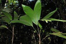
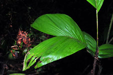
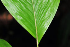
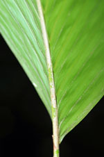
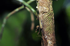
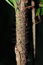
| Field notes | Colonial understory palm. Stem 1.78 m long, 1 cm thick, smooth, grey; internodes 4 cm long. Leaves 6; sheath 17 cm long, closed, with black spines to 1 m long; petiole 20 cm long, section round; rachis 23 cm long; lamina bifid, 46 cm long, 20 cm wide, hairy. Transect HB132, SU 085; UTM 20K-233557-8171139, in transect |


| |
 Other records of Bactris hirta Other records of Bactris hirtaThe map displays only records from the Aarhus Herbarium Database. The records may not represent the full distribution of Bactris hirta |
| New Search Modify Search |