AAU Herbarium Database |
| New Search Modify Search |
| Collector | Balslev, H. |
| Number | 8238 |
| Collected with | Dennis Pedersen, Narel Paniagua Zambrana, Manual Macia & Alexander Parada |
| Country | Bolivia |
| Subpart | Cochabamba/Beni |
| County | |
| Locality | 120 km NE of Cochabamba, 1.5 km NE of the San Benito village, next to the Isiboro river. Primary floodplain forest |
| Coordinates | 16° 31' 23.7'' S 65° 30' 12.5'' W |
| Minimum elevation (m) | 220 |
| Maximum elevation (m) | 220 |
| Start date | 2010/03/25 |
| End date | 2010/03/25 |
| Family | Arecaceae |
| Identification | Chamaedorea pinnatifrons (Jacq.)Oerst. |
| Determined by | Balslev H. |
| Identification qualifier | |
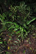
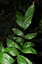
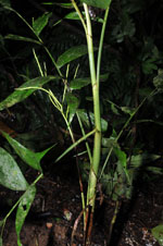
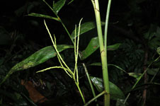
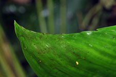
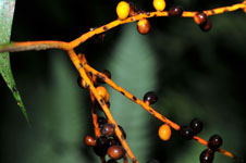
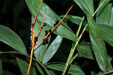
| Field notes | Solitary understory palm. Stem 2 m long, 1 cm thick, smooth, green; internodes 3 cm long. Leaves 6; sheath 13 cm long, closed; petiole 8 cm long, section round; rachis 50 cm long; lamina pinnate, glabrous; pinnae per side 6, regularly inserted. Inflorescence infrafoliar; peduncular bract 4 cm long, inserted 7 cm from the base, brown, herbaceous; peduncle 30 cm long, 0.5 cm wide; rachis 3 cm long, 0.4 cm wide; rachillae 5, 10-12 cm long. Flowers sessile, cream colored. Fruits 0.5 cm long, 0.5 cm wide, black. Transect HB128, SU 016; UTM 20K-232787-8171522, in transect |
| |
| Display all 228 georeferenced records of Chamaedorea Chamaedorea pinnatifrons |
| New Search Modify Search |