AAU Herbarium Database |
| New Search Modify Search |
| Collector | Balslev, H. |
| Number | 8221 |
| Collected with | D. Pedersen, L.S. Damgaard, K.Ø. Madsen, A. Alvarado, A. Serralta, A. Moo, O. Alvarado, R. Duno, G. Dzib & L.M. Calvo |
| Country | Mexico |
| Subpart | Quintana Roo |
| County | |
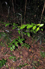
| Locality | Municipio Othón P. Blanco. 84 km SW of Chetumal, 9.5 km S of Ejido Tres Garantías. Semievergreen tropical rainforest on limestone |
| Coordinates | 18° 6' 19.4'' N 88° 59' 8.4'' W |
| Minimum elevation (m) | 170 |
| Maximum elevation (m) | 0 |
| Start date | 2010/02/26 |
| End date | 0/00/00 |
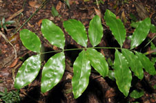
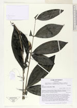
| Family | Arecaceae |
| Identification | Desmoncus orthacanthos Mart. |
| Determined by | H. Balslev |
| Identification qualifier | |
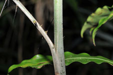
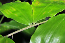
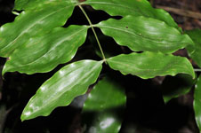
| Field notes | Juvenile. Cespitose understory palm. Stem 12 m long, 1.2 cm thick, smooth; internodes 13 cm long, green. Leaves 7; petiole 3-13 cm long, section margined, with black spines, 0.5-4,5 cm long; rachis 4-54 cm long, with black spines, 0.5-3.5 cm long; lamina pinnate, 8.5-34 cm wide, 7-61 cm long, flat, glabrous; pinnae 4-9 per side, basal pinna 4-18 cm long, middle pinna 5-17 cm long, apical pinna 4.5-12 cm long. Vernacular name: Bayal. Informant: Carlos Varguez. Transect HB1544, subunit no. 095; UTM 16Q-0289882-2002976. |
| |
 Other records of Desmoncus orthacanthos Other records of Desmoncus orthacanthosThe map displays only records from the Aarhus Herbarium Database. The records may not represent the full distribution of Desmoncus orthacanthos |
| New Search Modify Search |