| Collector | Balslev, H. |
| Number | 8205 |
| Collected with | D. Pedersen, L.S. Damgaard, K.Ø. Madsen, A. Alvarado, A. Serralta, A. Moo, O. Alvarado, R. Duno, G. Dzib & L.M. Calvo |
| Country | Mexico |
| Subpart | Quintana Roo |
| County | |
| Locality | Municipio Othón P. Blanco. 80 km SW of Chetumal, 19 km SE of the village of Ejido Caobas. Semievergreen tropical rainforest on limestone |
| Coordinates | 18° 17' 14.1'' N 89° 1' 37.6'' W |
| Minimum elevation (m) | 150 |
| Maximum elevation (m) | 0 |
| Start date | 2010/02/23 |
| End date | 0/00/00 |
| Family | Arecaceae |
| Identification | Chamaedorea oblongata Mart. |
| Determined by | H. Balslev |
| Identification qualifier | |
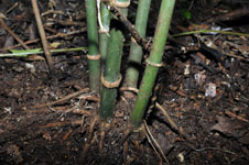
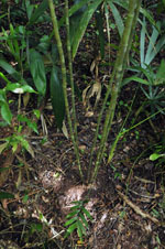
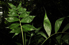
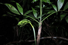
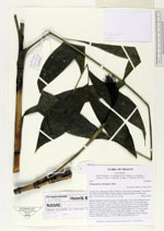
| Field notes | Solitary understory palm in groups of 5 adult palms. Root cone with many roots. Stem 2-3, 25 m long, 1-1.5 cm thick, smooth; internodes 2-14 cm long, green. Leaves 4-5 per stem; sheath 23 cm long, closed; petiole 21-47 cm long, section round; rachis 48-51 cm long; lamina pinnate, flat, glabrous; pinnae 8 per side, insertion regular, basal pinna 21 cm long, middle pinna 26-31 cm long, apical pinna 15-19 cm long. Inflorescence infrafoliar; rachillae 23-26 per rachis. Flower sessile, immature. Vernacular name: X·yat. Informant Carlos Varguez. Transect HB1538, subunit no. 052; UTM 16Q-0285718-2023157 |
|
 Other records of Chamaedorea oblongata