| Collected with | D. Pedersen, L.S. Damgaard, K.Ø. Madsen, A. Alvarado, A. Serralta, A. Moo, O. Alvarado, R. Duno, G. Dzib & L.M. Calvo |
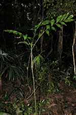
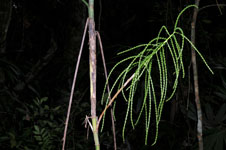
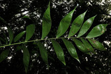
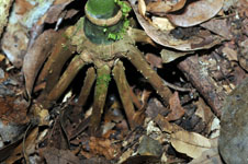
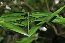
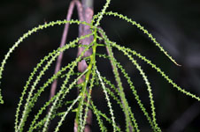
| Field notes | Understory palm. Root cone with 18 roots, 6-8 cm long, 0.5 cm thick. Stem 1.75 m long, 1 cm thick, smooth; internodes 3-13 cm long, green. Leaves 4 per stem; sheath 18 cm long, closed; petiole 20-36 cm long, section round; rachis 51-57 cm long; lamina pinnate, 50-56 cm wide, 55-70 cm long, flat, glabrous; pinnae 8-9 per side, insertion regular, basal pinna 18-23 cm long, middle pinna 26 cm long, apical pinna 16-17 cm long. Inflorescence infrafoliar; prophyll 2 cm long, 0.8 cm wide, papery; peduncular bracts 4, 3.5-11 cm long, inserted 0-10 cm from base, brown, papery; peduncle 21 cm long, 0.5 cm wide; rachis 11 cm long, 0.3-0.5 cm wide; rachillae 28 per rachis, 14-21 cm long. Flower sessile, immature. Vernacular name: X·yat. Informant Carlos Varguez. Transect HB1538, subunit no. 038; UTM 16Q-0285656-2023167 |
 Other records of Chamaedorea oblongata