| Collected with | D. Pedersen, L.S. Damgaard, K.Ø. Madsen, A. Alvarado, A. Serralta, A. Moo, O. Alvarado, R. Duno, G. Dzib & L.M. Calvo |
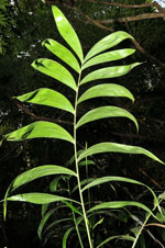
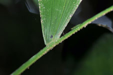
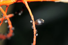
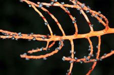
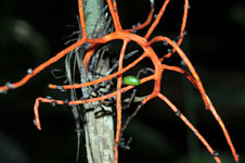
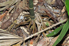
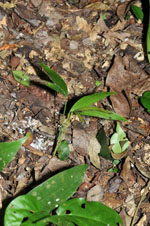
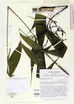
| Field notes | Solitary understory palm. Visible roots 27, 7-13 cm long, 0.3-0.5 cm wide, forming a root cone. Stem 164 cm long, 1-1.5 cm wide, smooth, covered by leaf bases apically; internodes 3-14 cm long, green. Leaves 4 per stem; sheaths closed, 22 cm long; petiole 22-30 cm long, section round; rachis 54-55 cm long; lamina pinnate, 60-62 cm wide, 70 cm long, flat, glabrous; pinnae 7-8 per side, insertion regular; basal pinna 26-27 cm long, middle pinna 28-30 cm long, apical pinna 16-17 cm long. Infructescence infrafoliar; prophyll 3-4 cm long, 0.5 cm wide, papery; peduncular bracts 4-6.5 cm long, 1 cm wide, brown, papery; peduncle 23 cm long, 0.6 cm wide; rachis 10 cm long, 0.3-0.5 cm wide; rachillae 17-23 per rachis, 5-12 cm long. Fruits 1 cm long, 0.7 cm wide, green-black. Vernacular name: X·yat. Informant Carlos Varguez. Transect HB1538, subunits no. 027+030; UTM 16Q-0285583-2023183 |

 Other records of Chamaedorea oblongata