AAU Herbarium Database |
| New Search Modify Search |
| Collector | Balslev, H. |
| Number | 8193 |
| Collected with | D. Pedersen, L.S. Damgaard, K.Ø. Madsen, A. Alvarado, A. Serralta, A. Moo, O. Alvarado, R. Duno, G. Dzib & L.M. Calvo |
| Country | Mexico |
| Subpart | Quintana Roo |
| County | |
| Locality | Municipio Othón P. Blanco. 84.5 km SW of Chetumal, 20 km SE of the village of Ejido Caobas (Chichán ja). Semievergreen tropical rainforest on limestone |
| Coordinates | 18° 16' 13'' N 89° 3' 57.1'' W |
| Minimum elevation (m) | 188 |
| Maximum elevation (m) | 0 |
| Start date | 2010/02/22 |
| End date | 0/00/00 |
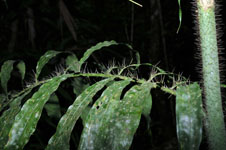
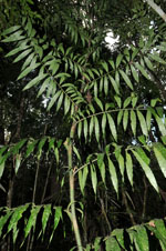
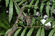
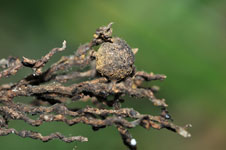
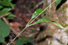
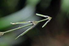
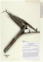
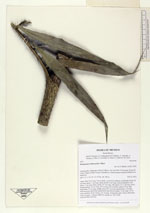
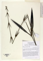
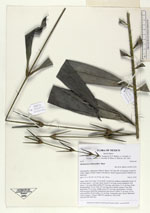
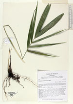
| Family | Arecaceae |
| Identification | Desmoncus orthacanthos Mart. |
| Determined by | H. Balslev |
| Identification qualifier | |
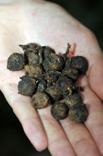
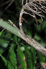
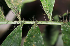
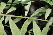
| Field notes | Liana. Stem 20 m long, 2-4 cm thick, covered by leafbases; leafsheath closed, 20 cm long; spines, 1 cm long, black; petiole 2 cm long, section margined, with spines, 1 cm long, black; rachis 207 cm long, with spines, 0.5-2 cm long, black; lamina pinnate, 56 cm wide, 207 cm long, flat to bushy; pinnae 27 per side, basal pinna 25 cm long, middle pinna 29.5 cm long, apical pinna 1 cm long. Infructescence interfoliar; peduncular bract brown; rachis 12 cm long, 0.4 cm wide; rachillae 28 per rachis, to 8 cm long. Vernacular name: Bayal. Informant: Carlos Varguez. Transect HB1536, subunit no. 030; UTM 16Q-0281600-2021322 |
| |
 Other records of Desmoncus orthacanthos Other records of Desmoncus orthacanthosThe map displays only records from the Aarhus Herbarium Database. The records may not represent the full distribution of Desmoncus orthacanthos |
| New Search Modify Search |