| Collected with | D. Pedersen, L.S. Damgaard, K.Ø. Madsen, A. Alvarado, A. Serralta, A. Moo, O. Alvarado, R. Duno, G. Dzib & L.M. Calvo |
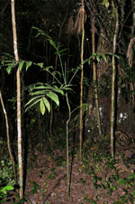
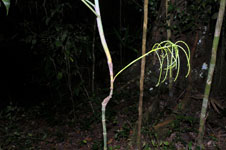
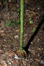
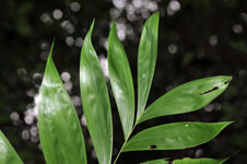
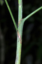
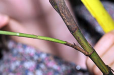
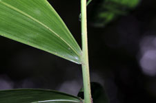
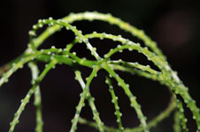
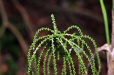
| Field notes | Understory palm. Stem 1.50 m long, 1 cm thick, smooth; internodes green, 1-11 cm long. Leaves 5 per stem; sheath 7.5 cm long, closed; petiole section round; rachis 42-46 cm long; lamina pinnate, flat, glabrous, pinnae 7-8 per side, insertion regular, basal pinna 12-13 cm long, middle pinna 23-24 cm long, apical pinna 15.5-18 cm long. Inflorescence infrafoliar; prophyll papery; peduncular bract 5.5 cm long, inserted 1 cm from base, green, herbaceous; peduncle 8.5 cm long, 0.4 cm wide; rachis 7.2 cm long, 0.3 cm wide; rachillae 12 per rachis, 12-13 cm long. Flowers sessile, immature. Vernacular name: X·yat. Informant Carlos Varguez. Transect HB1533, subunits no. 074+097+098; UTM 16Q-0286763-2017810 |

 Other records of Chamaedorea oblongata