| Collector | Balslev, H. |
| Number | 8180 |
| Collected with | D. Pedersen, L.S. Damgaard, K.Ø. Madsen, A. Alvarado, A. Serralta, A. Moo, O. Alvarado, R. Duno, G. Dzib & L.M. Calvo |
| Country | Mexico |
| Subpart | Quintana Roo |
| County | |
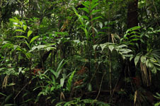
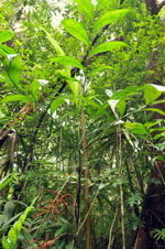
| Locality | Municipio Othón P. Blanco. 80 km W of Chetumal, 25 km SE of the village of Ejido Caobas, camino a Jaguactal. Semievergreen tropical rainforest on limestone |
| Coordinates | 18° 14' 23.9'' N 89° 0' 37.7'' W |
| Minimum elevation (m) | 210 |
| Maximum elevation (m) | 0 |
| Start date | 2010/02/20 |
| End date | 0/00/00 |
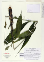
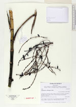
| Family | Arecaceae |
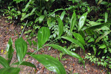
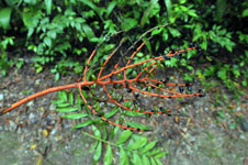
| Identification | Chamaedorea oblongata Mart. |
| Determined by | H. Balslev |
| Identification qualifier | |
| Field notes | Adult. Fruiting. Vernacular name: X·yat. Informant Carlos Varguez. From Transect HB1532, subunit no. 001; UTM 16Q-0287421-2017902 |
|
 Other records of Chamaedorea oblongata