AAU Herbarium Database |
| New Search Modify Search |
| Collector | Balslev, H. |
| Number | 8179 |
| Collected with | D. Pedersen, L.S. Damgaard, K.Ø. Madsen, A. Alvarado, A. Serralta, A. Moo, O. Alvarado, R. Duno, G. Dzib & L.M. Calvo |
| Country | Mexico |
| Subpart | Quintana Roo |
| County | |
| Locality | Municipio Othón P. Blanco. 78 km W of Chetumal, 24 km SE of the village of Ejido Caobas, camino a Jaguactal. Semievergreen tropical rainforest on limestone |
| Coordinates | 18° 15' 22.4'' N 88° 59' 54.2'' W |
| Minimum elevation (m) | 184 |
| Maximum elevation (m) | 0 |
| Start date | 2010/02/20 |
| End date | 0/00/00 |
| Family | Arecaceae |
| Identification | Chamaedorea oblongata Mart. |
| Determined by | H. Balslev |
| Identification qualifier | |
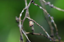
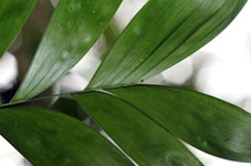
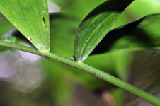
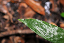
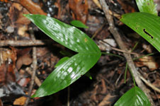
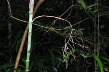
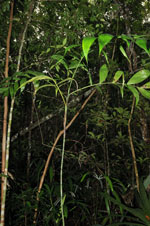
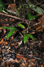
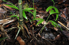
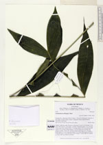
| Field notes | Solitary Understory palm. Rootcone with about 22 roots, 8-12 cm long, 0.5 cm thick. Stem smooth, 1.45 m high, 1 cm thick, internodes green, 2.5-12 cm long. Leaves 5 per stem; sheath closed, 17 cm long; petiole 19-27 cm, section round; rachis 52-54 cm long; lamina pinnate, 33-40 cm wide, 60-62 cm long, flat, glabrous; pinnae 7-8 per side, insertion regular, basal pinna 15-21 cm long, middle pinna 24-29 cm long, apical pinna 14 cm long. Inflorescence infrafoliar. Vernacular name: X·yat. Informant Carlos Varguez. Transect HB1532, subunit no. 036; UTM 16Q-0288719-2019687 |
| |
 Other records of Chamaedorea oblongata Other records of Chamaedorea oblongataThe map displays only records from the Aarhus Herbarium Database. The records may not represent the full distribution of Chamaedorea oblongata |
| New Search Modify Search |