| Collector | Balslev, H. |
| Number | 8167 |
| Collected with | D. Pedersen, L.S. Damgaard, K.Ø. Madsen, A. Alvarado, A. Serralta, A. Moo, O. Alvarado, R. Duno, G. Dzib & L.M. Calvo |
| Country | Mexico |
| Subpart | Quintana Roo |
| County | |
| Locality | Municipio Lázaro Cárdenas. 69 km W of Cancún, 22 km N of the village of Kantunilkín. Road to Sabana San Jacinto. Semideciduous tropical forest on shallow soil, on limestone |
| Coordinates | 21° 18' 12.2'' N 87° 11' 21.7'' W |
| Minimum elevation (m) | 18 |
| Maximum elevation (m) | 0 |
| Start date | 2010/02/12 |
| End date | 0/00/00 |
| Family | Arecaceae |
| Identification | Thrinax radiata Mart. |
| Determined by | H. Balslev |
| Identification qualifier | |
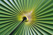
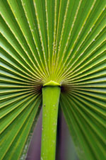
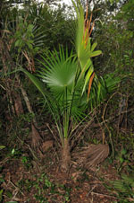
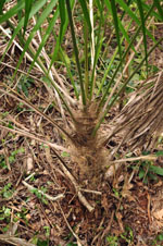
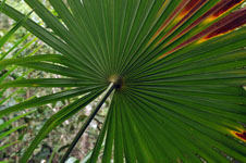
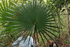
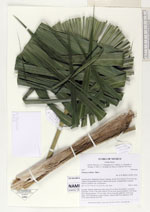
| Field notes | Juvenile. Solitary understory palm. Stem 30 cm high, 14 cm thick, covered by leaf bases: Leaves 7 per stem; petiole 226 cm long, section margined; leaf sheath open; lamina palmate, 127 cm wide, 124 cm long, flat, glabrous. Vernacular name: Ch'íit. Informant: Lázaro Chimal. Transect HB1514, subunit no. 064; UTM 16Q-0480359-2355738 |
|
 Other records of Thrinax radiata