| Collected with | D. Pedersen, L.S. Damgaard, K.Ø. Madsen, A. Alvarado, A. Serralta, A. Moo, O. Alvarado, R. Duno, G. Dzib & L.M. Calvo |
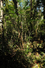
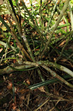
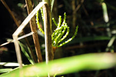
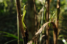
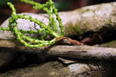
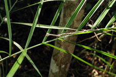
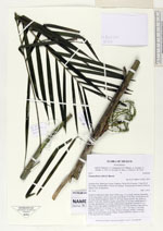
| Field notes | Cespitose understory palm. Stem 2.04 m long, 1.2 cm thick, smooth; internodes 18 cm long, green. Leaves 6 per stem; leaf sheath 14 cm long, closed; petiole 18 cm long, section margined; rachis 47 cm long; lamina pinnate, flat, glabrous; pinnae 13 per side, insertion regular, basal pinna 25 cm long, middel pinna 27 cm long, apical pinna 14 cm long. Inflorescence interfoliar; prophyll 0.6 cm long, 0.4 cm wide, papery; peduncular bract 2 cm long, inserted at base, brown, papery; peduncle 1.5 cm long, 0.5 cm wide; rachis 1 cm long, 0.5 cm wide, rachillae 5 per rachis, 7 - 9 cm long. Flowers immature, sessile. Vernacular name: X·yat. Informant Lázaro Chimal. Transect HB1503, subunit no. 093; UTM 16Q-0462760-2340430 |