| Collector | Balslev, H. |
| Number | 8150 |
| Collected with | D. Pedersen, L.S. Damgaard, K.Ø. Madsen, A. Alvarado, A. Serralta, A. Moo, O. Alvarado, R. Duno, G. Dzib & L.M. Calvo |
| Country | Mexico |
| Subpart | Quintana Roo |
| County | |
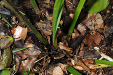
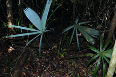
| Locality | Municipio Lázaro Cárdenas. 54 km W of Cancún, 15 km NE of the village of Kantunilkín. Terreno de “palmas”. Semievergreen tropical forest on shallow soil, on limestone |
| Coordinates | 21° 9' 41.2'' N 87° 21' 31.2'' W |
| Minimum elevation (m) | 14 |
| Maximum elevation (m) | 0 |
| Start date | 2010/02/07 |
| End date | 0/00/00 |
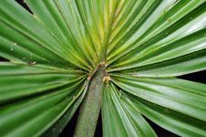
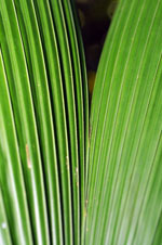
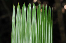
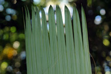
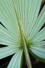
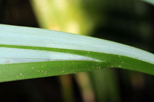
| Family | Arecaceae |
| Identification | Sabal yapa C.Wright ex Becc. |
| Determined by | H. Balslev |
| Identification qualifier | |
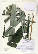
| Field notes | Juvenile. Solitary. Roots few, visible. No stem visible above ground. Leaves 5; leafsheath open; petiole 110 cm long, section margined; rachis 25 cm long; lamina palmate, 116 cm wide, 69 cm long, flat, glabrous. Vernacular name: Huano. Informant: Lázaro Chimal. Transect HB1503, subunit no. 019; UTM 16Q-0462763-2340057. |
|
 Other records of Sabal yapa