| Collector | Balslev, H. |
| Number | 8141 |
| Collected with | D. Pedersen, L.S. Damgaard, K.Ø. Madsen, A. Alvarado, A. Serralta, A. Moo, O. Alvarado, R. Duno, G. Dzib & L.M. Calvo |
| Country | Mexico |
| Subpart | Quintana Roo |
| County | |
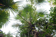
| Locality | Municipio Lázaro Cárdenas. 41 km W of Cancún, 27 km NE of the village of Kantunilkín. Ch'en Cura por mensura terrenos nacionales. Semievergreen tropical forest on shallow soil, on limestone |
| Coordinates | 21° 9' 32.3'' N 87° 13' 44.7'' W |
| Minimum elevation (m) | 22 |
| Maximum elevation (m) | 0 |
| Start date | 2010/02/05 |
| End date | 0/00/00 |
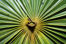
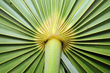
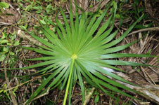
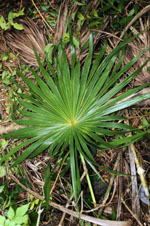
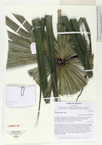
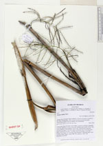
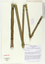
| Family | Arecaceae |
| Identification | Thrinax radiata Mart. |
| Determined by | H. Balslev |
| Identification qualifier | |
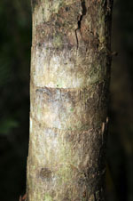
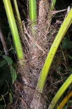
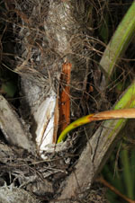
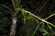
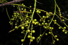
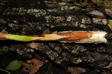
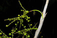
| Field notes | Solitary palm. Stem 3 m long, 12 cm in diam, covered by leaf bases; internodes 4 cm long, light brown. Leaves 22 per stem; leafsheat open; petiole 145 cm long, section margined; lamina palmate, 128 cm wide. Infructescence interfoliar; prophyll 11 cm long, 2.3 cm wide, papery; peduncular bract 14 cm long, grey, papery; peduncle 66 cm long, 1 cm wide; rachis 56 cm long, 0.6 cm wide; rachillae 7 per rachis, 2.5-15 cm long. Fruits immature. Vernacular name: Ch'íit. Informant Lázaro Chimal. Transect HB1500, subunit no. 040; UTM 16Q-0476218-2339760 |
|
 Other records of Thrinax radiata