| Collector | Balslev, H. |
| Number | 8140 |
| Collected with | D. Pedersen, L.S. Damgaard, K.Ø. Madsen, A. Alvarado, A. Serralta, A. Moo, O. Alvarado, R. Duno, G. Dzib & L.M. Calvo |
| Country | Mexico |
| Subpart | Quintana Roo |
| County | |
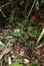
| Locality | Municipio Lázaro Cárdenas. 41 km W of Cancún, 27 km NE of the village of Kantunilkín. Ch'en Cura por mensura terrenos nacionales. Semievergreen tropical forest on shallow soil, on limestone |
| Coordinates | 21° 9' 32.9'' N 87° 13' 45.7'' W |
| Minimum elevation (m) | 26 |
| Maximum elevation (m) | 0 |
| Start date | 2010/02/05 |
| End date | 0/00/00 |
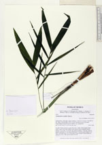
| Family | Arecaceae |
| Identification | Chamaedorea seifrizii Burret |
| Determined by | H. Balslev |
| Identification qualifier | |
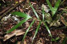
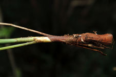
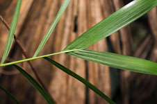
| Field notes | Juvenile. Solitary uderstory palm. Roots few, visible, without spines. Stem aerial. Leaves 5 per stem; sheath closed; petiole section margined; lamina pinnate, 25 cm wide, 22 cm long, flat, glabrous; pinnae 1-5 per side, insertion regular, basal pinna 10 cm long, middle pinna 13 cm long, apical pinna 13 cm long. Vernacular name: X·yat. Informant: Lázaro Chimal. Transect HB1500, subunit no. 034; UTM 16Q-0476189-2339778. |
|
 Other records of Chamaedorea seifrizii