AAU Herbarium Database |
| New Search Modify Search |
| Collector | Balslev, H. |
| Number | 8093 |
| Collected with | C. Grandez, D. Pedersen, B. Bergmann, G. del Aguila Panduro, Jim Chilo, A. Alvarado & J. Gonzales Baardales |
| Country | Peru |
| Subpart | Loreto |
| County | |
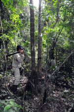
| Locality | Río Ucayali, 14.4 km W of Orellana, 185 km NW of Pucallpa. Km 17 on Orellana - El Dorado road. Primary forest. UTM 18M: 468613; 9236909 |
| Coordinates | 6° 54' 12.6'' S 75° 17' 2.8'' W |
| Minimum elevation (m) | 185 |
| Maximum elevation (m) | 0 |
| Start date | 2009/07/04 |
| End date | 0/00/00 |
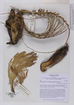
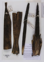
| Family | Arecaceae |
| Identification | Bactris gasipaes var. chichagui (H.Karst)A.J.Hend. |
| Determined by | Balslev H. |
| Identification qualifier | |
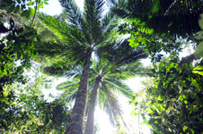
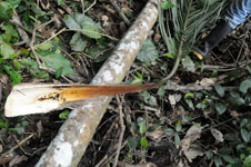
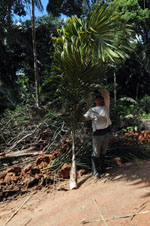
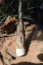
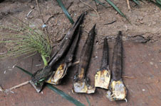
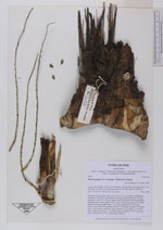
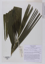
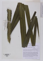
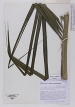
| Field notes | Cespitose canopy palm. Stem 16.6 m long, 14 cm in diameter, with spines; internodes 5 cm long. Leaf sheath 63 cm long, closed; petiole 52 cm long, margined; rachis 277 cm long, sheath, petiole and rachis with brown spines; lamina pinnate, bushy; pinnae 139 per side, inserted in groups of 4-5, basal pinna 60 cm long, middle pinna 78 cm long, apical pinna 33 cm long. Inflorescence interfoliar; peduncular bract 72 cm long, inserted 10 cm from base, woody, brown with black spines; peduncle 21 cm long, 2.5 cm thick, green; rachis 20 cm long, 1.7 cm thick, green; rachillae 57, 27-30 cm long, green. HB transect no. 401, along road to transect. |

| |
 Other records of Bactris gasipaes var. chichagui Other records of Bactris gasipaes var. chichaguiThe map displays only records from the Aarhus Herbarium Database. The records may not represent the full distribution of Bactris gasipaes var. chichagui |
| New Search Modify Search |