AAU Herbarium Database |
| New Search Modify Search |
| Collector | Balslev, H. |
| Number | 8092 |
| Collected with | C. Grandez, D. Pedersen, B. Bergmann, G. del Aguila Panduro, Jim Chilo, A. Alvarado & J. Gonzales Baardales |
| Country | Peru |
| Subpart | Loreto |
| County | |
| Locality | Río Ucayali, 14.4 km W of Orellana, 185 km NW of Pucallpa. Km 17 on Orellana - El Dorado road. Primary forest. UTM 18M: 468576; 9236964 |
| Coordinates | 6° 54' 10.8'' S 75° 17' 4'' W |
| Minimum elevation (m) | 179 |
| Maximum elevation (m) | 0 |
| Start date | 2009/07/04 |
| End date | 0/00/00 |
| Family | Arecaceae |
| Identification | Astrocaryum faranae F.Kahn & E.Ferreira |
| Determined by | Balslev H. |
| Identification qualifier | |
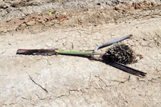
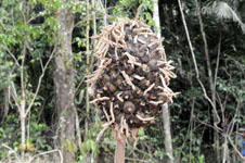
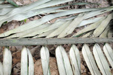
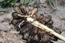
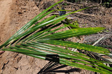
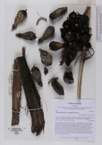
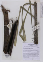
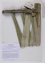
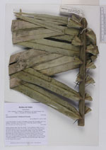
| Field notes | Solitary midstory palm. Stem 418 cm tall, 12 cm in diameter, rough. Leaves 9; leaf sheath+petiole more than 135 cm long; rachis 495 cm long, sheath, petiole and rachis with black spines; lamina pinnate; pinnae 100 per side, regularly inserted, in one single plane, basal pinna 72 cm long, middle pinna 123 cm long, apical pinna 49 cm long. Inflorescence interfoliar; prophyll more than 45 cm long, 9 cm wide, woody; peduncular bract 59 cm long, inserted 79 cm from base, brown, woody; peduncle 99 cm long, 3 cm thick, green; rachis 16 cm long, 3 cm thick; rachillae 110. Fruits ellipsoid, green with black spines. HB transect no. 401, along road to transect. |
| |
 Other records of Astrocaryum faranae Other records of Astrocaryum faranaeThe map displays only records from the Aarhus Herbarium Database. The records may not represent the full distribution of Astrocaryum faranae |
| New Search Modify Search |