| Collector | Balslev, H. |
| Number | 8090 |
| Collected with | C. Grandez, D. Pedersen, B. Bergmann, G. del Aguila Panduro, Jim Chilo, A. Alvarado & J. Gonzales Baardales |
| Country | Peru |
| Subpart | Loreto |
| County | |
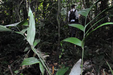
| Locality | Río Ucayali, 14.4 km W of Orellana, 185 km NW of Pucallpa. Km 17 on Orellana - El Dorado road. Disturbed primary forest. UTM 18M: 468398; 9237555 |
| Coordinates | 6° 53' 51.6'' S 75° 17' 9.8'' W |
| Minimum elevation (m) | 166 |
| Maximum elevation (m) | 0 |
| Start date | 2009/07/04 |
| End date | 0/00/00 |
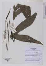
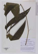
| Family | Arecaceae |
| Identification | Geonoma macrostachys var. acaulis (Mart.)A.J.Hend. |
| Determined by | Balslev H. |
| Identification qualifier | |
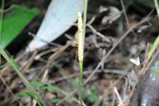
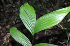
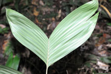
| Field notes | Solitary understory palm. Acaulescent. Leaves 5; leaf sheath 15 cm long, open; petiole 47 cm long, margined; rachis 33 cm long; lamina pinnate, pinnae 3-4 per side, irregularly inserted, in one single plane, basal pinna 27 cm long, middle pinna 28 cm long, apical pinna 23 cm long. Inflorescence interfoliar; peduncle 40 cm long, 0.3 cm thick, yellow-green; spike 8 cm long, 0.9 cm thick, yellow-green. Flowers in bud. HB transect 401, subunit 74. |
|