| Collector | Balslev, H. |
| Number | 8087 |
| Collected with | C. Grandez, D. Pedersen, B. Bergmann, G. del Aguila Panduro, Jim Chilo, A. Alvarado & J. Gonzales Baardales |
| Country | Peru |
| Subpart | Loreto |
| County | |
| Locality | Río Ucayali, 14.4 km W of Orellana, 185 km NW of Pucallpa. Km 17 on Orellana - El Dorado road. Disturbed primary forest. UTM 18M: 468362; 9237246 |
| Coordinates | 6° 54' 1.6'' S 75° 17' 11'' W |
| Minimum elevation (m) | 178 |
| Maximum elevation (m) | 0 |
| Start date | 2009/07/04 |
| End date | 0/00/00 |
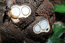
| Family | Arecaceae |
| Identification | Aphandra natalia (Balslev & A.J. Hend.) Barfod |
| Determined by | Balslev H. |
| Identification qualifier | |
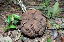
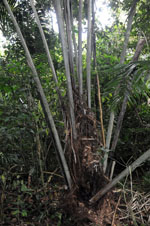
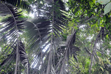
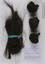
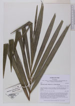
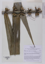
| Field notes | Solitary midstory palm. Acaulescent. Leaves 14; leaf sheath+petiole more than 420 cm long, basally with abundant fibers; rachis 690 cm long; lamina pinnate; pinnae 97 per side, regularly inserted, in one single plane, basal pinna 108 cm long, middle pinna 96 cm long, apical pinna 18 cm long. Infructescence interfoliar; peduncle more than 5 cm long, 4 cm thick. Fruits 30 per head; seeds to 4 per fruit. HB transect no. 401, subunit no. 8 |
|
 Other records of Aphandra natalia