AAU Herbarium Database |
| New Search Modify Search |
| Collector | Balslev, H. |
| Number | 8085 |
| Collected with | C. Grandez, D. Pedersen, B. Bergmann, G. del Aguila Panduro, Jim Chilo, A. Alvarado & J. Gonzales Baardales |
| Country | Peru |
| Subpart | Loreto |
| County | |
| Locality | Río Ucayali, 10 km W of Orellana, 181 km NW of Pucallpa. Km 11 on Orellana - El Dorado road, right side of road. Disturbed primary forest. UTM 18M: 473287; 9235500 |
| Coordinates | 6° 54' 58.6'' S 75° 14' 30.5'' W |
| Minimum elevation (m) | 177 |
| Maximum elevation (m) | 0 |
| Start date | 2009/07/03 |
| End date | 0/00/00 |
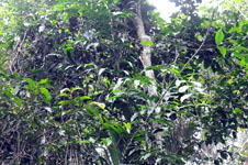
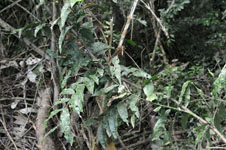
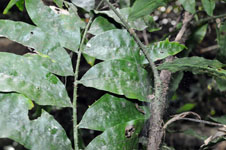
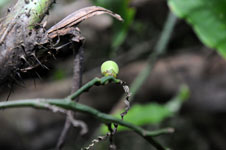
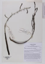
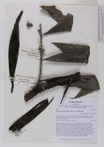
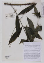
| Family | Arecaceae |
| Identification | Desmoncus polyacanthos Mart. |
| Determined by | A. Henderson |
| Identification qualifier | |
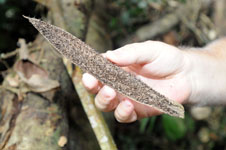
| Field notes | Liana. Stem aprox. 20 m long, 0.9 cm in diameter, green; Number of leaves aprox. 30, distributed along the stem; leaf sheath closed, more than 30 cm long; ocrea 19 cm long; petiole 9 cm long; rachis 42 cm long; cirrus 46 cm long; sheath, petiole and rachis with brown spines; lamina pinnate, flat; number of pinnae per side 7, pinnae more or less regularly inserted, basal pinna 10 cm long, middle pinna 14 cm long, apical pinna 17 cm long. Infructescence interfoliar; prophyll 15 cm long, 1 cm wide, herbaceous; peduncular bract more than 25 cm long, brown, covered with brown spines to 1 cm long; peduncle 26 cm long, 0.5 cm thick, green; rachis 20 cm long, 0.5 cm thick, green; rachillae 12, 5-7 cm long, green. Fruits ellipsoid green. HB transect no. 400, subunit 60. |
| |
| Display all 53 georeferenced records of Desmoncus Desmoncus polyacanthos |
| New Search Modify Search |