AAU Herbarium Database |
| New Search Modify Search |
| Collector | Balslev, H. |
| Number | 8078 |
| Collected with | C. Grandez, D. Pedersen, B. Bergmann, G. del Aguila Panduro, Jim Chilo, A. Alvarado & J. Gonzales Baardales |
| Country | Peru |
| Subpart | Loreto |
| County | |
| Locality | Río Ucayali, 6 km NW of Orellana, 181 km NW of Pucallpa. Disturbed primary forest on tierra firme. UTM 18M: 476464; 9237257 |
| Coordinates | 6° 54' 1.4'' S 75° 12' 47'' W |
| Minimum elevation (m) | 143 |
| Maximum elevation (m) | 0 |
| Start date | 2009/07/03 |
| End date | 0/00/00 |
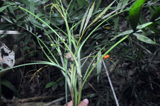
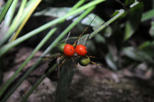
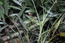
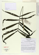
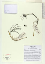
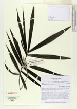
| Family | Arecaceae |
| Identification | Wendlandiella gracilis var. gracilis Dammer |
| Determined by | Stauffer & Eychenne |
| Identification qualifier | |
| Field notes | Cespitose understory palm. Stem 1 m tall, smooth. Leaf sheath 10 cm long, closed; petiole 22 cm long; rachis 15 cm long; lamina pinnate; pinnae 6 per side, inserted in groups of 2, basal pinna 20 cm long, middle pinna 25 cm long, apical pinna 20 cm long. Infructescence interfoliar; prophyll 8 cm long; peduncular bract 12 cm long, inserted 3.5 cm from base; peduncle 17 cm long, 0.3 cm thick, green; rachis 3 cm long, 0.2 cm thick, green; rachillae 9, 3-4 cm long, green. Flowers sessile, yellow. Fruits globular-ellipsoid, orange-green. HB transect no. 399, subunit 43. |
| |
 Other records of Wendlandiella gracilis var. gracilis Other records of Wendlandiella gracilis var. gracilisThe map displays only records from the Aarhus Herbarium Database. The records may not represent the full distribution of Wendlandiella gracilis var. gracilis |
| New Search Modify Search |