| Collector | Balslev, H. |
| Number | 8074 |
| Collected with | C. Grandez, D. Pedersen, B. Bergmann, G. del Aguila Panduro, Jim Chilo, A. Alvarado & J. Gonzales Baardales |
| Country | Peru |
| Subpart | Loreto |
| County | |
| Locality | Río Ucayali, 6.5 km W of Orellana, 179 km NW of Pucallpa. Km 7 on Orellana - El Dorado road, right side of the road. Disturbed primary forest. UTM 18M: 476437; 9235471 |
| Coordinates | 6° 54' 59.6'' S 75° 12' 47.9'' W |
| Minimum elevation (m) | 174 |
| Maximum elevation (m) | 0 |
| Start date | 2009/07/02 |
| End date | 0/00/00 |
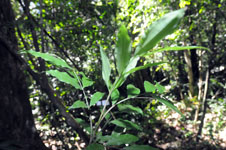
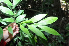
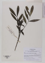
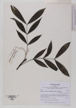
| Family | Arecaceae |
| Identification | Desmoncus mitis subsp. leptospadix (Mart.) A.J. Hend. |
| Determined by | Balslev H. |
| Identification qualifier | |
| Field notes | Juvenile. Cespitose. HB transect no. 398, subunit 85 |
|