| Collector | Balslev, H. |
| Number | 8067 |
| Collected with | C. Grandez, D. Pedersen, B. Bergmann, G. del Aguila Panduro, Jim Chilo, A. Alvarado & J. Gonzales Baardales |
| Country | Peru |
| Subpart | Loreto |
| County | |
| Locality | Río Ucayali, 7.5 km W of Orellana, 179 km NW of Pucallpa. Km 8 on Orellana - El Dorado road, left side of the road. Disturbed primary forest. UTM 18M: 475217; 9234480 |
| Coordinates | 6° 55' 31.8'' S 75° 13' 27.6'' W |
| Minimum elevation (m) | 171 |
| Maximum elevation (m) | 0 |
| Start date | 2009/07/02 |
| End date | 0/00/00 |
| Family | Arecaceae |
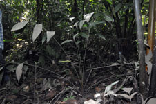
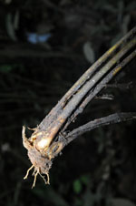
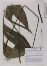
| Identification | Geonoma macrostachys var. acaulis (Mart.)A.J.Hend. |
| Determined by | Balslev H. |
| Identification qualifier | |
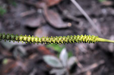
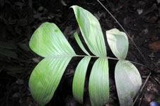
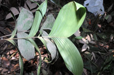
| Field notes | Solitary understory palm. Acaulescent. Leaves 8; leaf sheath 15 cm long, open; petiole 75 cm long, margined; rachis 38 cm long; lamina pinnate; pinnae 3 per side, irregularly inserted, in one single plane, basal pinna 29 cm long, middle pinna 30 cm long, apical pinna 26 cm long. Inflorescence interfoliar; prophyll 10 cm long, 1 cm wide, papery; peduncle 43 cm long, 0.5 cm thick, green; spike 15 cm long, 1 cm thick, green. Flowers sunken. HB transect 397, subunit 24. |
|