AAU Herbarium Database |
| New Search Modify Search |
| Collector | Balslev, H. |
| Number | 8055 |
| Collected with | C. Grandez, D. Pedersen, B. Bergmann, G. del Aguila Panduro, Jim Chilo, A. Alvarado & J. Gonzales Baardales |
| Country | Peru |
| Subpart | Loreto |
| County | |
| Locality | Río Ucayali, 5.6 km NW of Orellana, 182 km NW of Pucallpa. Disturbed primary forest. UTM 18M: 479377; 9240486 |
| Coordinates | 6° 52' 16.3'' S 75° 11' 12'' W |
| Minimum elevation (m) | 168 |
| Maximum elevation (m) | 0 |
| Start date | 2009/07/01 |
| End date | 0/00/00 |
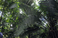
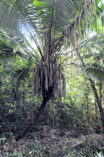
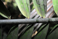
| Family | Arecaceae |
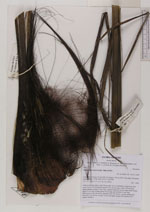
| Identification | Phytelephas macrocarpa Ruiz & Pav. |
| Determined by | Balslev H. |
| Identification qualifier | |
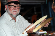
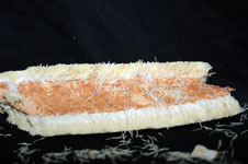
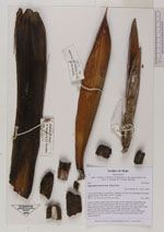
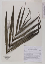
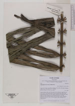
| Field notes | Solitary midstory palm; stem 226 cm tall, 16 cm in diameter, rough from leaf scars. Leaves 33; leaf sheath+petiole 138-152 cm long; rachis 344 cm long; lamina pinnate; pinnae 74 per side, regularly inserted, in one single plane, basal pinna 16 cm long, middle pinna 58 cm long, apical pinna 16 cm long. Inflorescence bud, interfoliar, prophyll 36x7 cm, brown, woody; peduncular bract 44x7 cm, brown, woody. Vernacular name: yarina. HB transect 395, outside subunit 4. |

| |
 Other records of Phytelephas macrocarpa Other records of Phytelephas macrocarpaThe map displays only records from the Aarhus Herbarium Database. The records may not represent the full distribution of Phytelephas macrocarpa |
| New Search Modify Search |