| Collector | Balslev, H. |
| Number | 8053 |
| Collected with | C. Grandez, D. Pedersen, B. Bergmann, G. del Aguila Panduro, Jim Chilo, A. Alvarado & J. Gonzales Baardales |
| Country | Peru |
| Subpart | Loreto |
| County | |
| Locality | Río Ucayali, 20 km NE of Orellana, 180 km NW of Pucallpa. W shore of oxbow lake, 4 km S of the village of Belaunde. Primary forest, periodically flooded. UTM 18M: 500212; 9245438 |
| Coordinates | 6° 49' 35.2'' S 74° 59' 53.1'' W |
| Minimum elevation (m) | 139 |
| Maximum elevation (m) | 0 |
| Start date | 2009/06/30 |
| End date | 0/00/00 |
| Family | Arecaceae |
| Identification | Astrocaryum jauari Mart. |
| Determined by | Balslev H. |
| Identification qualifier | |
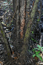
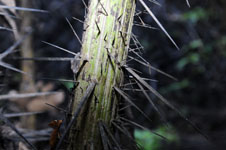
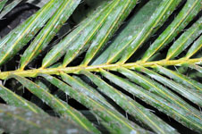
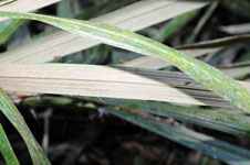
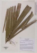
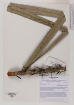
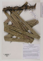
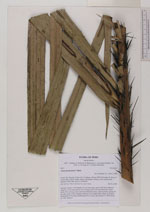
| Field notes | Juvenile. Leaves 7; leaf sheath 120 cm long, open, green with black flattened spines to 15 cm long; petiole 190 cm long, green with black flattened spines; rachis 256 cm long, green with black flattened spines; lamina pinnate; pinnae 68 per side, more or less regularly inserted, in one single plane, spiny on margins, basal pinna 99 cm long, middle pinna 94 cm long, apical pinna 37. HB transect no. 394, subunit 7 |
|
 Other records of Astrocaryum jauari