| Collector | Balslev, H. |
| Number | 8048 |
| Collected with | C. Grandez, D. Pedersen, B. Bergmann, G. del Aguila Panduro, Jim Chilo, A. Alvarado & J. Gonzales Baardales |
| Country | Peru |
| Subpart | Loreto |
| County | |
| Locality | Río Ucayali, 18 km E of Orellana, 170 km NW of Pucallpa. 2 hours by boat upriver from the village of Alfonzo Ugarte and 1 hour walking. Primary forest on tierra firme. UTM 18M: 500514; 9234738 |
| Coordinates | 6° 55' 23.6'' S 74° 59' 43.2'' W |
| Minimum elevation (m) | 154 |
| Maximum elevation (m) | 0 |
| Start date | 2009/06/29 |
| End date | 0/00/00 |
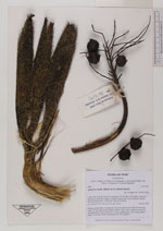
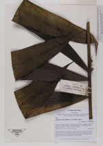
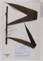
| Family | Arecaceae |
| Identification | Aphandra natalia (Balslev & A.J. Hend.) Barfod |
| Determined by | Balslev H. |
| Identification qualifier | |
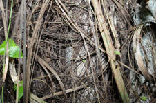
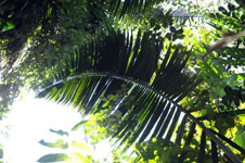
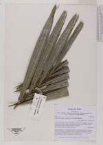
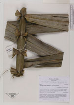
| Field notes | Solitary canopy palm. Acaulescent. Leaves 9; petiole more than 225 cm long; rachis 776 cm long; lamina pinnate; pinnae 109 per side, regularly inserted, in one single plane, basal pinna 140 cm long, middle pinna 112 cm long, apical pinna 23 cm long. Sterile. HB transect no. 392, subunit 5 |

|
 Other records of Aphandra natalia