| Collector | Balslev, H. |
| Number | 8037 |
| Collected with | C. Grandez, D. Pedersen, B. Bergmann, G. del Aguila Panduro, Jim Chilo, A. Alvarado & J. Gonzales Baardales |
| Country | Peru |
| Subpart | Loreto |
| County | |
| Locality | Río Ucayali, 16 km SE of Orellana, 161 km NW of Pucallpa. Village of Monte de los Olivos, 3 km E of the village. Mountain ridge. Open canopy forest on sandy soil. UTM 18M: 492113; 9222758 |
| Coordinates | 7° 1' 53.7'' S 75° 4' 17.1'' W |
| Minimum elevation (m) | 553 |
| Maximum elevation (m) | 0 |
| Start date | 2009/06/26 |
| End date | 0/00/00 |
| Family | Arecaceae |
| Identification | Geonoma macrostachys var. macrostachys Mart. |
| Determined by | H. Balslev |
| Identification qualifier | |
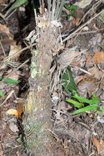
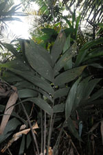
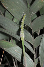
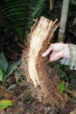
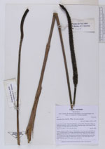
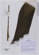
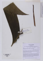
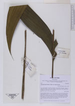
| Field notes | Solitary understory palm. Leaves 7; leaf sheath 14 cm long, open; petiole 49 cm long, margined; rachis 62 cm long; lamina pinnate; pinnae 3 per side, regularly inserted, in one single plane, basal pinna 58 cm long, middle pinna 48 cm long, apical pinna 41 cm long. Infructescence interfoliar; peduncular bract more than 33 cm long, brown, papery; peduncle 88 cm long, 0.4 cm wide; spike 19 cm long, 1 cm wide, green. HB transect 390, subunit 88. |
|