| Collector | Balslev, H. |
| Number | 8035 |
| Collected with | C. Grandez, D. Pedersen, B. Bergmann, G. del Aguila Panduro, Jim Chilo, A. Alvarado & J. Gonzales Baardales |
| Country | Peru |
| Subpart | Loreto |
| County | |
| Locality | Río Ucayali, 16 km SE of Orellana, 161 km NW of Pucallpa. Village of Monte de los Olivos, 3 km E of the village. Mountain ridge. Open canopy forest on sandy soil. UTM 18M: 492013; 9222766 |
| Coordinates | 7° 1' 53.5'' S 75° 4' 20.3'' W |
| Minimum elevation (m) | 493 |
| Maximum elevation (m) | 0 |
| Start date | 2009/06/26 |
| End date | 0/00/00 |
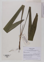
| Family | Arecaceae |
| Identification | Attalea microcarpa Mart. |
| Determined by | Balslev H. |
| Identification qualifier | |
| Field notes | Seedling. HB transect no. 390, subunit 65 |
|
 Other records of Attalea microcarpa