| Collector | Balslev, H. |
| Number | 8032 |
| Collected with | C. Grandez, D. Pedersen, B. Bergmann, G. del Aguila Panduro, Jim Chilo, A. Alvarado & J. Gonzales Baardales |
| Country | Peru |
| Subpart | Loreto |
| County | |
| Locality | Río Ucayali, 16 km SE of Orellana, 161 km NW of Pucallpa. Village of Monte de los Olivos, 3 km E of the village. Mountain ridge. Open canopy forest on sandy soil. UTM 18M: 491728; 9222662 |
| Coordinates | 7° 1' 56.9'' S 75° 4' 29.6'' W |
| Minimum elevation (m) | 478 |
| Maximum elevation (m) | 0 |
| Start date | 2009/06/26 |
| End date | 0/00/00 |
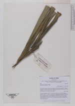
| Family | Arecaceae |
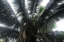
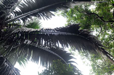
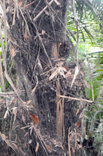
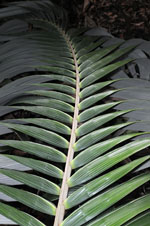
| Identification | Oenocarpus bataua Mart. |
| Determined by | Balslev H. |
| Identification qualifier | |
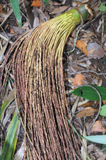
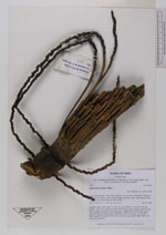
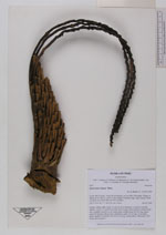
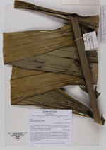
| Field notes | Solitary canopy palm. Stem 7 m tall, 65 cm in diameter, covered by old leaf sheaths. Leaves 15; rachis more than 604 cm long; lamina pinnate; pinnae 85 per side, regularly inserted, in one single plane, middle pinna 160 cm long, apical pinna 40 cm long. Inflorescence infrafoliar; rachis 18 cm long, 12 cm thick, green; number of rachillae 199, 69-83 cm long, cream/yellow. HB transect 390, along trail to transect. |

|