AAU Herbarium Database |
| New Search Modify Search |
| Collector | Balslev, H. |
| Number | 8031 |
| Collected with | C. Grandez, D. Pedersen, B. Bergmann, G. del Aguila Panduro, Jim Chilo, A. Alvarado & J. Gonzales Baardales |
| Country | Peru |
| Subpart | Loreto |
| County | |
| Locality | Río Ucayali, 16 km SE of Orellana, 161 km NW of Pucallpa. 2 km E of the Village of Monte de los Olivos. Transect starts at the foot of the hills and goes up. Undisturbed primary forest on hills. Sandy soil. UTM 18M: 491509; 9222088 |
| Coordinates | 7° 2' 15.6'' S 75° 4' 36.8'' W |
| Minimum elevation (m) | 336 |
| Maximum elevation (m) | 0 |
| Start date | 2009/06/26 |
| End date | 0/00/00 |
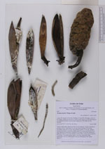
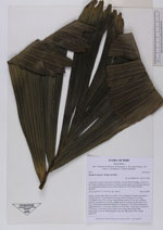
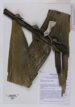
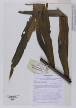
| Family | Arecaceae |
| Identification | Wettinia augusta Poepp. & Endl. |
| Determined by | Balslev H. |
| Identification qualifier | |
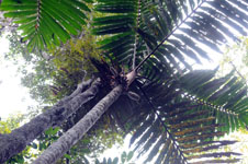
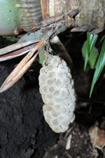
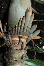
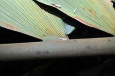
| Field notes | Solitary canopy palm. Stem 6.5 m tall, 10 cm in diameter, smooth; internodes 2 cm long. Leaves 7; leaf sheath 95 cm long, closed, forming a 95 cm long crownshaft; rachis 240 cm long; lamina pinnate; pinnae 27 per side, regularly inserted, basal pinna 13 cm long, middle pinna 93 cm long, apical pinna 28 cm long. Inflorescence infrafoliar; prophyll 2.8 cm long, 2.5 cm wide, herbaceous; peduncular bracts 17 cm long, inserted 5 cm from base, woody, brown; peduncle 12 cm long, 1.5 cm thick, green; rachis 15 cm long, unbranched. Male inflorescence 15x2 cm. Infructescence 20x5 cm. HB transect 389, outside subunit 53. |

| |
 Other records of Wettinia augusta Other records of Wettinia augustaThe map displays only records from the Aarhus Herbarium Database. The records may not represent the full distribution of Wettinia augusta |
| New Search Modify Search |