AAU Herbarium Database |
| New Search Modify Search |
| Collector | Balslev, H. |
| Number | 8025 |
| Collected with | C. Grandez, D. Pedersen, B. Bergmann, G. del Aguila Panduro, Jim Chilo, A. Alvarado & J. Gonzales Baardales |
| Country | Peru |
| Subpart | Loreto |
| County | |
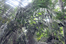
| Locality | Río Ucayali, 16 km SE of Orellana, 161 km NW of Pucallpa. 2 km E of the Village of Monte de los Olivos. Transect starts at the foot of the hills and goes up. Undisturbed primary forest on hills. Sandy soil. UTM 18M: 491443; 9222073 |
| Coordinates | 7° 2' 16'' S 75° 4' 38.9'' W |
| Minimum elevation (m) | 310 |
| Maximum elevation (m) | 0 |
| Start date | 2009/06/26 |
| End date | 0/00/00 |
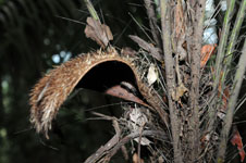
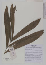
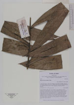
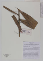
| Family | Arecaceae |
| Identification | Bactris macroacantha Mart. |
| Determined by | Balslev H. |
| Identification qualifier | |
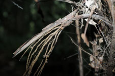
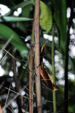
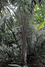
| Field notes | Solitary understory palm. Stem 100 cm long, 2.3 cm in diameter, smooth; internodes 3 cm long. Number of leaves 10; leaf sheath more than 21 cm long, closed, spiny; petiole 55 cm long, spiny; rachis 136 cm long; lamina pinnate, bushy; pinnae per side 16, inserted in groups of 1-2, basal pinna 24 cm long, middle pinna 32 cm long, apical pinna 27 cm long. Inflorescence interfoliar; prophyll more than 14 cm long, 2 cm wide; peduncular bract 38 cm long, inserted more than 2 cm from base, woody, brown, spiny; peduncle 24 cm long, 0.6 cm long; rachis 3.5 cm long, 0.3 cm wide; rachillae 11, 9-10 cm long. HB transect 389, outside subunit 37. |
| |
| Display all 27 georeferenced records of Bactris Bactris macroacantha |
| New Search Modify Search |