AAU Herbarium Database |
| New Search Modify Search |
| Collector | Balslev, H. |
| Number | 8015 |
| Collected with | C. Grandez, D. Pedersen, B. Bergmann, G. del Aguila Panduro, Jim Chilo, A. Alvarado & J. Gonzales Baardales |
| Country | Peru |
| Subpart | Loreto |
| County | |
| Locality | Río Ucayali, 14 km SE of Orellana, 163 km NW of Pucallpa, 1.5 km E of the Village of Monte de los Olivos. Primary forest on very steep slopes. UTM 18M: 490264; 9223097 |
| Coordinates | 7° 1' 42.7'' S 75° 5' 17.4'' W |
| Minimum elevation (m) | 208 |
| Maximum elevation (m) | 0 |
| Start date | 2009/06/25 |
| End date | 0/00/00 |
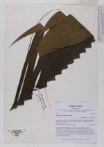
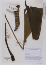
| Family | Arecaceae |
| Identification | Geonoma brongniartii Mart. |
| Determined by | Balslev H. |
| Identification qualifier | |
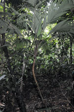
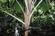
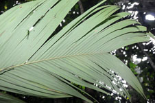
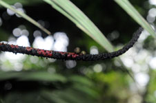
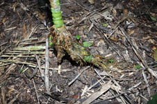
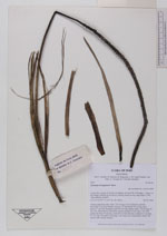
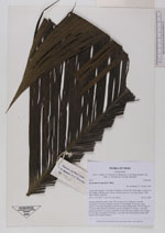
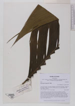
| Field notes | Solitary understory palm. Stem 130 cm long, 8 cm in diameter, smooth; internodes 2 cm long; Number of leaves 13; leaf sheath 18 cm long, open; petiole 37 cm long, margined; rachis 84 cm long; lamina entire, 124 cm long, 43 cm wide. Infructescence interfoliar, spicate; prophyll 26 cm long, 1 cm wide; peduncular bract 20 cm long, inserted 8 cm from the base; peduncle 41 cm long, 0.4 cm wide, red; spike 44 cm long, 1 cm wide, red. Fruits globose, black. HB transect 388, outside subunit 2. |
| |
| Display all 110 georeferenced records of Geonoma Geonoma brongniartii |
| New Search Modify Search |