AAU Herbarium Database |
| New Search Modify Search |
| Collector | Balslev, H. |
| Number | 8014 |
| Collected with | C. Grandez, D. Pedersen, B. Bergmann, G. del Aguila Panduro, Jim Chilo, A. Alvarado & J. Gonzales Baardales |
| Country | Peru |
| Subpart | Loreto |
| County | |
| Locality | Río Ucayali, 14 km SE of Orellana, 163 km NW of Pucallpa, 1.5 km E of the Village of Monte de los Olivos. Primary forest on very steep slopes. UTM 18M: 489560; 9223075 |
| Coordinates | 7° 1' 43.4'' S 75° 5' 40.3'' W |
| Minimum elevation (m) | 153 |
| Maximum elevation (m) | 0 |
| Start date | 2009/06/25 |
| End date | 0/00/00 |
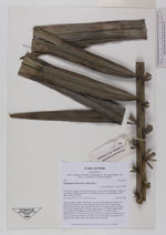
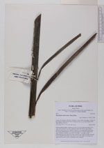
| Family | Arecaceae |
| Identification | Phytelephas macrocarpa Ruiz & Pav. |
| Determined by | Balslev H. |
| Identification qualifier | |
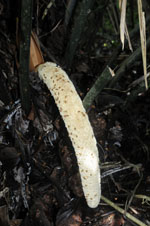
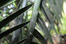
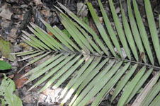
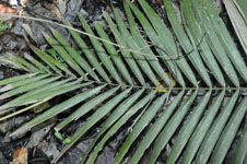
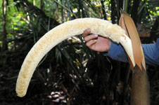
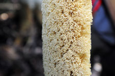
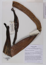
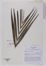
| Field notes | Solitary midstory palm. Acaulescent. Leaves 25; leaf sheath more than 30 cm long, open; petiole 28 cm long, margined; rachis 340-440 cm long; lamina pinnate, pinnae 90 per side, regularly inserted, in one single plane, basal pinna 42 cm long, middle pinna 70 cm long, apical pinna 15 cm long. Inflorescence male, interfoliar; prophyll more than 30 cm long, 11 cm wide, woody; peduncular bract more than 50 cm long, inserted more than 6 cm above the base, brown; peduncle more than 35 cm long, 5.5 cm wide; spike 63 cm long, 8 cm wide. Flowers cream, sessile. HB transect 388, to transect. |
| |
 Other records of Phytelephas macrocarpa Other records of Phytelephas macrocarpaThe map displays only records from the Aarhus Herbarium Database. The records may not represent the full distribution of Phytelephas macrocarpa |
| New Search Modify Search |