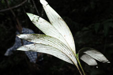
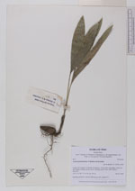
| Collector | Balslev, H. |
| Number | 8012 |
| Collected with | C. Grandez, D. Pedersen, B. Bergmann, G. del Aguila Panduro, Jim Chilo, A. Alvarado & J. Gonzales Baardales |
| Country | Peru |
| Subpart | Loreto |
| County | |
| Locality | Río Ucayali, 15 km SE of Orellana, 162 km NW of Pucallpa. 1 km E of the Village of Monte de los Olivos. Primary forest. UTM 18M: 490091; 9222546 |
| Coordinates | 7° 2' .6'' S 75° 5' 23'' W |
| Minimum elevation (m) | 187 |
| Maximum elevation (m) | 0 |
| Start date | 2009/06/25 |
| End date | 0/00/00 |
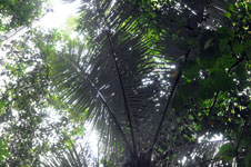
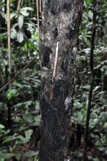
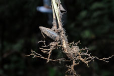
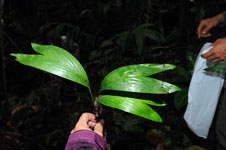
| Family | Arecaceae |
| Identification | Astrocaryum faranae F.Kahn & E.Ferreira |
| Determined by | Balslev H. |
| Identification qualifier | |
| Field notes | Seedling and fruits collected. HB transect 387, subunit 78. |
|
 Other records of Astrocaryum faranae