| Collector | Balslev, H. |
| Number | 8005 |
| Collected with | C. Grandez, D. Pedersen, B. Bergmann, G. del Aguila Panduro, Jim Chilo, A. Alvarado & J. Gonzales Baardales |
| Country | Peru |
| Subpart | Loreto |
| County | |
| Locality | Río Ucayali, 20 km S of Orellana, 159 km NW of Pucallpa. Tall primary forest on flat ground. UTM 18M: 486032; 9217192 |
| Coordinates | 7° 4' 55'' S 75° 7' 35.3'' W |
| Minimum elevation (m) | 0 |
| Maximum elevation (m) | 0 |
| Start date | 2009/06/24 |
| End date | 0/00/00 |
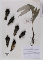
| Family | Arecaceae |
| Identification | Astrocaryum faranae F.Kahn & E.Ferreira |
| Determined by | Balslev H. |
| Identification qualifier | |
| Field notes | HB transect no. 386, subunit no. 27. |
|
 Other records of Astrocaryum faranae