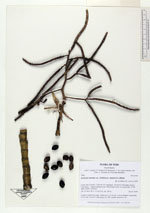
| Collector | Balslev, H. |
| Number | 7988 |
| Collected with | C. Grandez, D. Pedersen, B. Bergmann, G. del Aguila Panduro, Jim Chilo, A. Alvarado & J. Gonzales Baardales |
| Country | Peru |
| Subpart | Loreto |
| County | |
| Locality | Río Ucayali, 17 km NE of Contamana, 139 km N of Pucallpa. End of Contamana - Aguas Calientes road. Tall primary forest on steep slopes. UTM 18M: 505697; 9203267 |
| Coordinates | 7° 12' 28.5'' S 74° 56' 54.2'' W |
| Minimum elevation (m) | 234 |
| Maximum elevation (m) | 0 |
| Start date | 2009/06/20 |
| End date | 0/00/00 |
| Family | Arecaceae |
| Identification | Geonoma maxima var. chelidonura (Spruce)A.J.Hend. |
| Determined by | Balslev H. |
| Identification qualifier | |
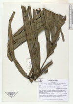
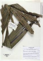
| Field notes | Cespitose understory palm. Stems up to 3.5 cm tall, 2 cm in diameter; internodes 12 cm long. Leaves 9. HB transect no. 382, outside subunit no. 84 |
|