AAU Herbarium Database |
| New Search Modify Search |
| Collector | Balslev, H. |
| Number | 7976 |
| Collected with | C. Grandez, D. Pedersen, B. Bergmann, G. del Aguila Panduro, Jim Chilo, A. Alvarado & J. Gonzales Baardales |
| Country | Peru |
| Subpart | Loreto |
| County | |
| Locality | Río Ucayali, 10 km NE of Contamana, 135 km N of Pucallpa. Km 13 on Contamana - Aguas Calientes road, left side of road. Primary forest. UTM 18M: 500785; 9197436 |
| Coordinates | 7° 15' 38.4'' S 74° 59' 34.4'' W |
| Minimum elevation (m) | 171 |
| Maximum elevation (m) | 0 |
| Start date | 2009/06/19 |
| End date | 0/00/00 |
| Family | Arecaceae |
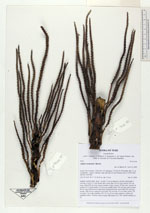
| Identification | Attalea tessmannii Burret |
| Determined by | Balslev H. |
| Identification qualifier | |
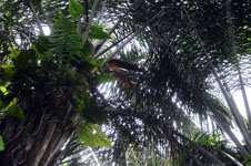
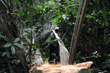
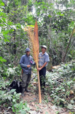
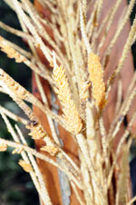
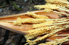
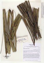
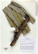
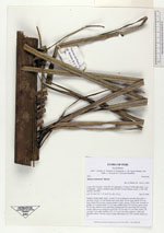
| Field notes | Solitary canopy palm. Stem 7 m tall, 47 cm in diameter, smooth; internodes 5 cm long. Leaves 16; leaf sheath open, more than 106 cm long; petiole 204 cm long; rachis 858 cm long; lamina pinnate, bushy; pinnae 195 per side, inserted in groups of 2-5, basal pinna 110 cm long, middle pinna 138 cm long, apical pinna 54 cm long. Inflorescence interfoliar; peduncular bract more than 250 cm long, woody, light brown; peduncle more than 119 cm long, 4.5 cm wide; rachis 139 cm long, 3 cm wide; rachillae 235, 25.5 to 28 cm long; peduncle, rachis and rachillae yellow. Flowers yellow/cream. HB transect no. 380, outside subunit no. 22 |
| |
 Other records of Attalea tessmannii Other records of Attalea tessmanniiThe map displays only records from the Aarhus Herbarium Database. The records may not represent the full distribution of Attalea tessmannii |
| New Search Modify Search |