| Collector | Balslev, H. |
| Number | 7971 |
| Collected with | C. Grandez, D. Pedersen, B. Bergmann, G. del Aguila Panduro, Jim Chilo, A. Alvarado & J. Gonzales Baardales |
| Country | Peru |
| Subpart | Loreto |
| County | |
| Locality | Río Ucayali, 6 km N of Contamana, 132 km NW of Pucallpa. Km 8 on Contamana - Aguas Calientes road, left side of road. Primary forest on slopes. UTM 18M: 499107; 9193308 |
| Coordinates | 7° 17' 52.8'' S 75° 0' 29.1'' W |
| Minimum elevation (m) | 174 |
| Maximum elevation (m) | 0 |
| Start date | 2009/06/18 |
| End date | 0/00/00 |
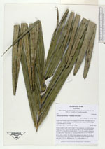
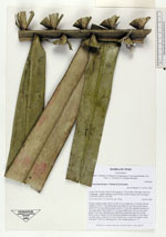
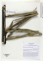
| Family | Arecaceae |
| Identification | Astrocaryum faranae F.Kahn & E.Ferreira |
| Determined by | Balslev H. |
| Identification qualifier | |
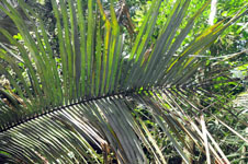
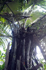
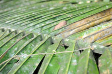
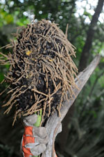
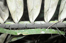
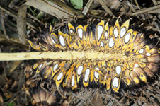
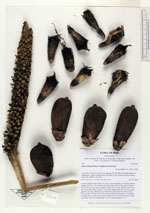
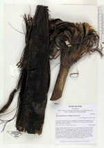
| Field notes | Solitary midstory palm. Stem 5 m tall, 22 cm in diameter, covered by old leaf sheaths. Leaves 11; leaf sheath open, more than 104 cm long; petiole absent; rachis 693 cm long; lamina pinnate; pinnae 127 per side, regularly inserted, in one single plane; basal pinna 127 cm long, middle pinna 140 cm long, apical pinna 42 cm long. Infructescence interfoliar; peduncular bract 84 cm long, brown, spiny, inserted 104 cm from base; peduncle more than 133 cm long, 5 cm wide, green; rachis 35 cm long. Fruits brown, covered with spines; rachis with fruits 35x26 cm. HB transect no. 379, outside subunit no. 27. |
|
 Other records of Astrocaryum faranae