AAU Herbarium Database |
| New Search Modify Search |
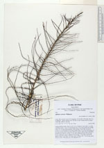
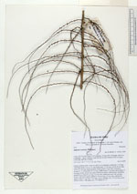
| Collector | Balslev, H. |
| Number | 7970 |
| Collected with | C. Grandez, D. Pedersen, B. Bergmann, G. del Aguila Panduro, Jim Chilo, A. Alvarado & J. Gonzales Baardales |
| Country | Peru |
| Subpart | Loreto |
| County | |
| Locality | Río Ucayali, 6 km N of Contamana, 132 km NW of Pucallpa. Km 8 on Contamana - Aguas Calientes road, left side of road. Primary forest on slopes. UTM 18M: 499138; 9193343 |
| Coordinates | 7° 17' 51.7'' S 75° 0' 28.1'' W |
| Minimum elevation (m) | 174 |
| Maximum elevation (m) | 0 |
| Start date | 2009/06/18 |
| End date | 0/00/00 |
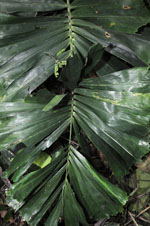
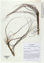
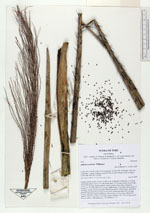
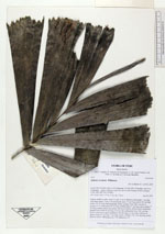
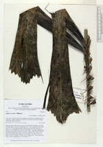
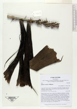
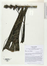
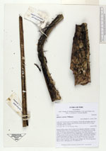
| Family | Arecaceae |
| Identification | Aiphanes horrida (Jacq.) Burret |
| Determined by | H.Balslev |
| Identification qualifier | |
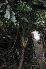
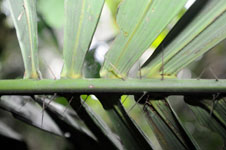
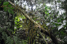
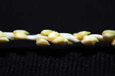
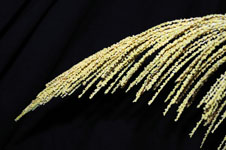
| Field notes | Solitary midstory palm. Stem 9 m tall, 8 cm in diameter; internodes 7 cm long, with black spines. Leaves 14; leaf sheath open, 37 cm long; petiole 48 cm long; rachis 187 cm long; lamina pinnate, bushy; pinnae 35 per side, inserted in groups of 1-6, basal pinna 26 cm long, middle pinna 37 cm long, apical pinna 17 cm long; sheath, petiole and rachis with brown spines. Inflorescence interfoliar; prophyll more than 66 cm long, 4.5 cm wide; peduncular bract 260 cm long, brown, with brown spines; peduncle 164 cm long, 1.5 cm wide, with brown spines; rachis 93 cm long, 1 cm wide, green; rachillae 126, 1-36 cm long, green. Flowers yellow. HB transect no. 379, subunit no. 22. |
| |
| Display all 28 georeferenced records of Aiphanes Aiphanes horrida |
| New Search Modify Search |