| Collector | Balslev, H. |
| Number | 7964 |
| Collected with | C. Grandez, D. Pedersen, B. Bergmann, G. del Aguila Panduro, Jim Chilo, A. Alvarado & J. Gonzales Baardales |
| Country | Peru |
| Subpart | Loreto |
| County | |
| Locality | Río Ucayali, 9 km SE of Contamana, 120 km NW of Pucallpa, about 5 km inland. Tall primary forest on hilly ground. UTM 18M: 507725; 9184065 |
| Coordinates | 7° 22' 53.8'' S 74° 55' 48'' W |
| Minimum elevation (m) | 190 |
| Maximum elevation (m) | 0 |
| Start date | 2009/06/16 |
| End date | 0/00/00 |
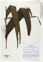
| Family | Arecaceae |
| Identification | Geonoma macrostachys var. macrostachys Mart. |
| Determined by | H. Balslev |
| Identification qualifier | |
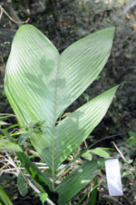
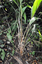
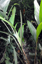
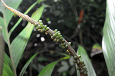
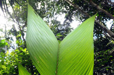
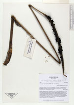
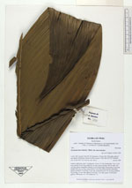
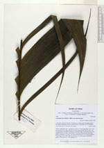
| Field notes | Solitary understory palm. Acaulescent. Leaves 15; leaf sheath open, over 11 cm long; petiole 38 cm long; rachis 85 cm long; lamina pinnate, 44 cm wide, 103 cm long; pinnae irregularly inserted, in one single plane, basal pinna 42 cm long, middle pinna 44 cm long, apical pinna 57 cm long. Infructescence interfoliar, spicate; prophyll 12 cm long, 2 cm wide; peduncular bract 31 cm long; peduncle 76 cm long, 0.5 cm wide; spike 22 cm long, 1 cm wide, green. Fruits green, globose. HB transect no. 376, subunit no. 73 |
|