AAU Herbarium Database |
| New Search Modify Search |
| Collector | Balslev, H. |
| Number | 7963 |
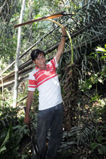
| Collected with | C. Grandez, D. Pedersen, B. Bergmann, G. del Aguila Panduro, Jim Chilo, A. Alvarado & J. Gonzales Baardales |
| Country | Peru |
| Subpart | Loreto |
| County | |
| Locality | Río Ucayali, 9 km SE of Contamana, 120 km NW of Pucallpa, about 5 km inland. Tall primary forest on hilly ground. UTM 18M: 507692; 9184085 |
| Coordinates | 7° 22' 53.1'' S 74° 55' 49.1'' W |
| Minimum elevation (m) | 202 |
| Maximum elevation (m) | 0 |
| Start date | 2009/06/16 |
| End date | 0/00/00 |
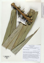
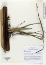
| Family | Arecaceae |
| Identification | Attalea tessmannii Burret |
| Determined by | Balslev H. |
| Identification qualifier | |
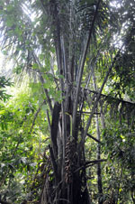
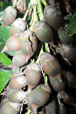
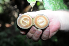
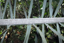
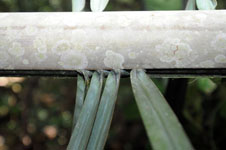
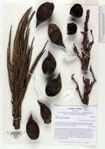
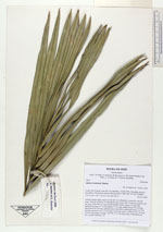
| Field notes | Solitary canopy palm. Stem 3 m tall, 44 cm in diameter, covered by old leaf bases. Number of leaves 13; leaf sheath open, more than 70 cm long; petiole 206 cm long; rachis 890 cm long; lamina pinnate, bushy; pinnae 220 per side, inserted in groups of 1-4, basal pinna 73 cm long, middle pinna 106 cm long, apical pinna 36 cm long. Infructescence interfoliar; peduncular bract over 240 cm long; peduncle over 137 cm long, 4 cm wide, green; rachis 99-122 cm long, 3.5 cm wide, green; rachillae 100-150, to 14 cm long, green. HB transect no. 376, outside subunit no. 66 |
| |
 Other records of Attalea tessmannii Other records of Attalea tessmanniiThe map displays only records from the Aarhus Herbarium Database. The records may not represent the full distribution of Attalea tessmannii |
| New Search Modify Search |