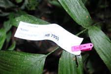
| Collector | Balslev, H. |
| Number | 7955 |
| Collected with | C. Grandez, D. Pedersen, B. Bergmann, G. del Aguila Panduro, Jim Chilo, A. Alvarado & J. Gonzales Baardales |
| Country | Peru |
| Subpart | Loreto |
| County | |
| Locality | Río Ucayali, 17 km NW of Contamana, 144 km NW of Pucallpa. Near the village of Shanaillo, 2 km N of Laguna Shanailla. Tall primary forest on tierra fierme. Hilly. UTM 18M: 491877; 9203443 |
| Coordinates | 7° 12' 22.7'' S 75° 4' 24.9'' W |
| Minimum elevation (m) | 158 |
| Maximum elevation (m) | 0 |
| Start date | 2009/06/15 |
| End date | 0/00/00 |
| Family | Arecaceae |
| Identification | Geonoma macrostachys var. acaulis (Mart.)A.J.Hend. |
| Determined by | Balslev H. |
| Identification qualifier | |
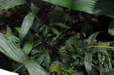
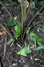
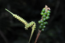
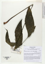
| Field notes | Solitary, understory palm. Acaulecent. Leaves 6; sheath open, 7 cm long; petiole 57 cm long; rachis 30 cm long; lamina pinnate; number of pinnae per side 3, regularly inserted, in one single plane, basal pinna 20 cm long, middle pinna 23 cm long, apical pinna 24 cm long. Infructescence interfoliar, spicate; peduncle 56 cm long, 0.3 cm wide; spike 17 cm long, 0.5 cm wide green. Fruits green, globose. HB transect no. 375, subunit no. 42 |
|