| Collector | Balslev, H. |
| Number | 7954 |
| Collected with | C. Grandez, D. Pedersen, B. Bergmann, G. del Aguila Panduro, Jim Chilo, A. Alvarado & J. Gonzales Baardales |
| Country | Peru |
| Subpart | Loreto |
| County | |
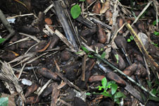
| Locality | Río Ucayali, 17 km NW of Contamana, 144 km NW of Pucallpa. Near the village of Shanaillo, 2 km N of Laguna Shanailla. Tall primary forest on tierra fierme. Hilly. UTM 18M: 491822; 9203443 |
| Coordinates | 7° 12' 22.7'' S 75° 4' 26.7'' W |
| Minimum elevation (m) | 151 |
| Maximum elevation (m) | 0 |
| Start date | 2009/06/15 |
| End date | 0/00/00 |
| Family | Arecaceae |
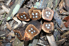
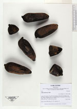
| Identification | Attalea phalerata Mart. |
| Determined by | Balslev H. |
| Identification qualifier | |
| Field notes | Fruits collected. HB transect no. 375, subunit no. 35 |
|
 Other records of Attalea phalerata