AAU Herbarium Database |
| New Search Modify Search |
| Collector | Balslev, H. |
| Number | 7947 |
| Collected with | C. Grandez, D. Pedersen, B. Bergmann, G. del Aguila Panduro, Jim Chilo, A. Alvarado & J. Gonzales Baardales |
| Country | Peru |
| Subpart | Loreto |
| County | |
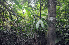
| Locality | Río Ucayali, 41 km SW of Contamana, 101 km NW of Pucallpa. N side of Río Pisqui. Primary forest, often flooded. UTM 18M: 485261; 9148996 |
| Coordinates | 7° 41' 55.7'' S 75° 8' 1.1'' W |
| Minimum elevation (m) | 157 |
| Maximum elevation (m) | 0 |
| Start date | 2009/06/14 |
| End date | 0/00/00 |
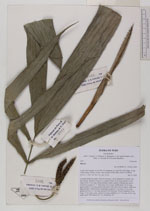
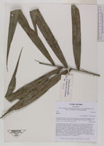
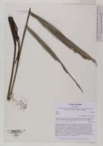
| Family | Arecaceae |
| Identification | Bactris |
| Determined by | Balslev H. |
| Identification qualifier | sp. 5 |
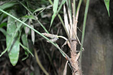
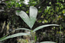
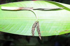
| Field notes | Colonial understory palm. Stem 53 cm long, 2 cm in diameter covered by old leaf sheaths. Number of leaves 12; sheath closed, 15 cm long; petiole 32 cm long; rachis 52 cm long; lamina pinnate, bushy; number of pinnae per side 8, inserted in groups of 1-3, basal pinna 26 cm long, middle pinna 32 cm long, apical pinna 33 cm long; petiole and rachis with yellow-brown spines, darkest at base and apex. Infructescence interfoliar; prophyll 13 cm long, 1.9 cm wide; peduncular bract 17 cm long, inserted 8 cm from base, brown; peduncle 19 cm long, 1.5 cm wide, green; rachis 0 cm long; rachillae 2, to 7 cm long. Fruits very small, green. HB transect no. 373, subunit no. 24 |
| |
| Display all 106 georeferenced records of Bactris Bactris |
| New Search Modify Search |